Cruise Ship Heads South to Avoid Tropical System
A tropical cyclone is brewing near northeastern Australia and Queen Elizabeth is impacted. What about other ships?
 oujisama
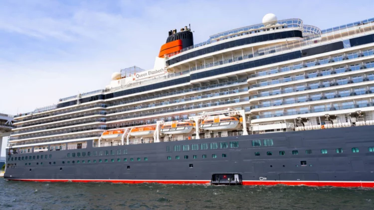
Guests boarding Cunard Line’s Queen Elizabeth in Sydney, Australia on Monday, January 22, 2024 will unfortunately not be enjoying the Great Barrier Reef itinerary that was originally planned.
Due to a developing tropical cyclone, the ship’s itinerary has been completely altered and the ship will be sailing south rather than north to ensure a safer and more comfortable voyage.
Queen Elizabeth Itinerary Change
Guests setting sail on Queen Elizabeth today will not be taking the planned cruise to Queensland and the Great Barrier Reef. This is due to the influence of a developing tropical cyclone in the Coral Sea with a track that will likely make landfall exactly when the ship would have been sailing off the Queensland coast.
The original itinerary for the 10-night sailing was to have included visits to Brisbane, Airlie Beach, Cairns, Port Douglas, and Willis Island. Unfortunately, those ports of call are directly in the path of the storm.
Now, Queen Elizabeth will instead be visiting Eden on Tuesday, January 23; Melbourne for an overnight call from Wednesday (January 24) morning until Thursday (January 25) evening; Adelaide on Saturday, January 27; and Port Lincoln on Sunday, January 28.
The remainder of the itinerary – Friday, January 26 as well as the last three days, January 23-31, will be days at sea. The ship’s departure from and return to Sydney are not impacted.

Cruise lines frequently adjust itineraries in the case of severe weather. Depending on the size and intensity of the storm, as well as its projected path, this might mean cancelling or substituting a port of call, reversing an itinerary to avoid the worst of the storm, or even completely altering a sailing to a new region and all new destinations.
Read Also: How a Hurricane Could Affect Your Cruise
The 90,901-gross-ton, Vista-class Queen Elizabeth can welcome 2,081 guests at double occupancy and is also home to 911 international crew members to provide the line’s distinctive luxury service.
Other Ships Possibly Impacted
In addition to Cunard Line’s Queen Elizabeth, several other cruise lines may also have itineraries impacted near Queensland in the coming days, depending on their planned itineraries.
While most other vessels sailing from Sydney are focused on New Zealand and south Australia itineraries, ships homeported from Brisbane may have itinerary changes. This could include Royal Caribbean International’s Quantum of the Seas, P&O Australia’s Pacific Encounter, and Princess Cruises’ Coral Princess.

In December 2023, Quantum of the Seas had a similar complete itinerary change due to an earlier tropical cyclone.
Travelers booked on any ships in the region this week should stay in close contact with their cruise line to stay updated on any possible itinerary impacts, delays, or cancellations.
About Cyclone Kirrily
The low that will become Tropical Cyclone Kirrily is currently located 425 kilometers (265 miles) east of Willis Island, and is moving slowly southwest toward the Queensland coast. At the moment, the storm’s sustained winds are measured at 55 kilometers per hour (34 miles per hour), with gusts as high as 85 kph (53 mph).
The storm is expected to significantly intensify over the next few days as it draws closer to the Australian coast, with landfall forecast somewhere between Innisfail and Airlie Beach on Thursday, January 25. The storm could be as strong as a Category 3 cyclone at the time of landfall, which is similar to a Category 1 tropical hurricane as measured for Caribbean storms.
After landfall, the storm is likely to make a turn to the south and the intensity will gradually decrease over the inland areas, though significant flooding and wind damage could still be possible.
Residents in the projected impact area are urged to take appropriate precautions, particularly in coastal areas. Gale watch alerts are not in effect from Cairns to St. Lawrence, indicating gale force winds are expected to arrive within 24 to 48 hours.